Well I am back in a chilly Scotland!
Now it is time to sieve through the data, maps and samples. Start putting together some ideas as to what is going on at Menengai on geological terms.
The rock samples are currently in Nairobi. Still? I hear you say. Why? I hear you ask. Well to export rock samples a permit is needed and before that a research permit is also needed. And despite advance applications I am still waiting. The Kenyans are just the most friendly people ever, but there is no sense of urgency. We westerners rush around like headless chickens. The Kenyans? Well things get done when they get done. Thats just their chilled out approach to just about everything.
So what else? Well there are school visits planned and seminars to do. As well as digitise maps and write reports. And of course start to plan the next field season.
Keep following this blog for updates on results, information posts and plans for the next trip!
Lala Salama from Scotland this time!!!
Friday 3 October 2014
Tuesday 23 September 2014
Day 19 - Fancy Technology!
Today was the last day in the caldera. The end of our time
here has almost arrived. I have had the most amazing time, met some amazing
people who I will stay in touch with and the caldera has most certainly been
the hardest field location I have worked in to date. I can’t wait to come back
next year! I suspect there will be a few tears tonight and tomorrow when we
leave. Most of the staff are coming in tonight to say good bye.

Me, Jenny, Florence and chef Samuel. This was a teary good bye, thanks to Flo!

Security check point!
Firstly, we went to visit Great Rift Drilling’s Rig 1, owned
by Cluff Geothermal, now that it is fully constructed. It’s a much smaller set
up than the rig we visited on Day 2. Hydraulics are used to control the drill
string in this case. It is much more compact, takes 4 days to take down, move
and reconstruct; compared to the 21 days for the larger rigs owned by GDC. They
also cost a tenth of the cost to move compared with the GDC rigs. The amount of
water used is vastly reduced with these rigs as more often than not, air is
used to lubricate and to raise drill cuttings to the surface. The only time water
is used to excess is when the lithology is very loose or unconsolidated. This is when cave ins, or sluffs, occur within the drilled hole. Mud contributes to keeping
the lithology where it is, stopping debris filling the bottom of the hole. In
this instance, when the water and mud returns to the surface, it is sieved so
it can all be reused. These rigs can drill to 3000m, in comparison to 7000m for
the larger rigs. However at Menengai, the maximum depth is 3200m, which was a
one off. The rig can also case to 2000m. It is packed with wireless technology,
meaning it takes less manpower to work and control and it is overall more
accurate. All in all it is a much more cost effective piece of equipment and
brilliant with it! There are currently four in the world, so the viability of
the rig in this location is being tested. It is an amazing bit of kit,
incredibly impressive!
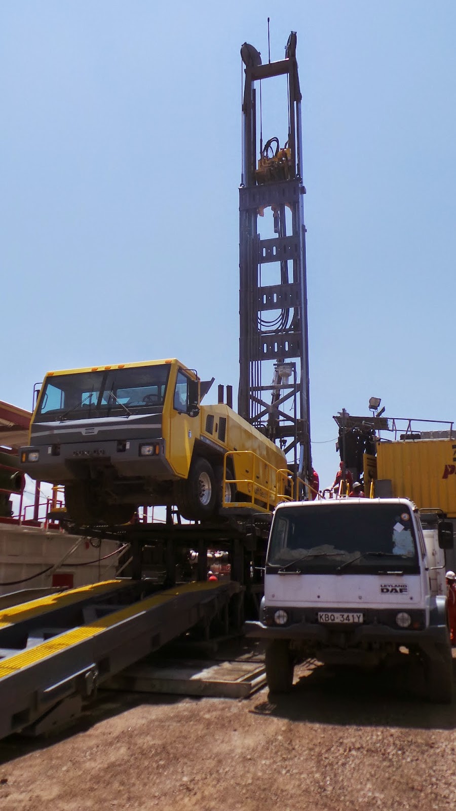
Cluff Rig, Great Rift Drilling 1

Cluff Rig, Great Rift Drilling 1

My remote control toy is bigger than yours! At the drill controls.
While talking to Jeff the rig manager, he told us about a
problem they encountered while drilling the proposed well MS-14. They took the
drill to 600m and began to cement the hole. But the cement didn’t seem to do
its job, it just seem to disappear in to the hole. When he described the
cuttings that were coming to the surface it sounded like tuff. The description
was brown light weight pebbles, sometimes broken up. It may have been the
pumice fall out associated with early stages of tuff deposits. The porosity of
this could certainly explain why the cement didn’t do its job. It would also
potentially explain why we haven’t seen deposits within the caldera associated
with its collapse.
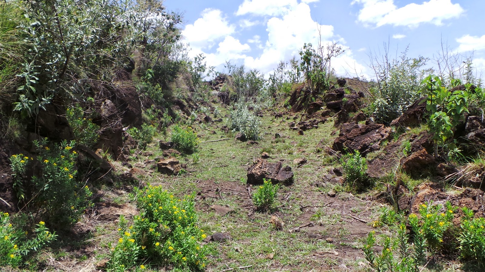
The next task of the day was to return to the fault in the
NW corner of the caldera, discovered on Day 10. As access to the caldera walls
has been limited I wanted return to this location to try and collect more
structural data. More fractures were measured. We also discovered a fault plane
that had a different trend to the one measured on Day 10. It had the same pale
hardened coating of what is likely to be clay. It also had large slickenlines
which were also measured. I am still playing around with what this fault might
mean as it hasn’t been recorded in any literature. The different trends of the
fault(s) may be because the fault is scalloped and is part of a small collapse
of the NW crater. Or it may be two different faults and have nothing to do with
any collapse. What we did notice was how unstable the area is. Since our last
visit just 9 days ago, more of the cliff has collapsed on to the road making
access with the car even harder. So we didn’t spend too much time there.
This was followed with a quick visit to the fumaroles by
well MW-10 where we cooked breakfast. I just wanted to collect samples of the
altered rock to analyse. We also went back to the second set of fumaroles
discovered on Day 13. I wanted to check the surface above the fumaroles to see
if there were any emanations higher up. There were small ones that weren’t too
hot, the alteration of the rocks was less and they were close to a large
fracture that may have been a low energy fissure. There were also elongate
depressions along the surface that may be fractures that have not quite
propagated to the surface, but the surface trace is due to land subsidence in to
the fractures.
I have unexpectedly got involved with Ujima Foundation while
here. An amazing charity that gives young men and women from the local
communities a chance to train in the hospitality industry. The trainees are
usually those who have had a struggle in life and may never have had the
opportunity to escape from hardship if it wasn’t for the foundation.

Lillian
Tomorrow, we are off to Lake Bogoria, in part a day off, but
we won’t be able to help ourselves, we will still find geology to look at.
There is little to no understanding as to why the flooding has occurred and
Lake Bogoria is not the only lake that has flooded. All the EAR lakes in Kenya
have flooded and some in Ethiopia are demonstrating the same. One thought is
the continuing stretching and thinning of the crust has resulted in fracture
and/or fault propagation downwards in to the aquifers. Hydrothermal fluid
contamination has been recorded in two lakes in Ethiopia.
Monday 22 September 2014
Day 18 - Always Expect the Unexpected
Today we returned to the northern part of the caldera to
investigate a deep gulley running almost NE-SW along the caldera wall.
According to the contours on the site map, the gulley dropped from an elevation
of just over 1800m to just over 1300m and back up again, over a distance of
about 200m. First observations of this structure were made from the road on Day 13. From this vantage point the gulley looked like it may have formed during the caldera collapse, where in this area, the core of the volcano detached from the caldera wall during this collpase phase. Both the caldera wall and the opposing wall appear to be steep. The position of the gulley matches that of inferred NE-SW striking faults of
Mariita (2013). It also meant we may have another opportunity to observe the
caldera walls and potentially collect structural data. The nose of the NW crater flow is also at this location.

The distance to the caldera wall looks much further than it actually was. Jenny was route decider today!
The nearest road was about 800m east of our intended
destination. Walking in the approximatly west, the topography had a gentle
slope down towards the northwest, with three sudden drop offs every 150m or so.
These steep drops were the nose ends of three separate ropey flows we had
previously observed in multiple locations across the caldera. They were also
easy to climb down with rubbly flow ends forming natural deep steps.

One of the clambers down the lava flows
Almost arriving at the southern side of the NW crater lava
flow, we met a farmer, who was a little wary of us. Once our driver had spoken to him about what we were
doing he relaxed a little.
On arriving at the location we discovered that the gulley was not quite what we were expecting. Instead of our exciting inference, admittedly made from a distance, the gulley only had vertical walls on the side of the caldera wall. The opposite side of the gulley is made up of nose ends of ropey lava flow lobes, the flow being about 10m think. Sadly there were no structures to measure.
Jenny and I discussed the course of action regarding
getting up to the caldera walls. Along large lengths of the caldera wall, there
have been landslips, all of which were potentially blocking our route up to the
caldera wall. We decided to walk down the sloping topography following the
south edge of the lavas from the NW crater and assess the stability of the
landslips when we were at their bases. We were just about to leave, when the farmer said
something to Vincent our driver in Swahili. Vincent quickly advised us not to
go any further as the thick vegetation at the base of the slope is the day time
resting place for three leopards.

The above image shows the debris along the caldera wall that has accumulated during recent small scale landslips. The rich green vegetation is leopard home!
From as close as we were aloud to get (our driver worries!) we could see vertical fractures in the caldera wall that had a strike of almost E-W. Again it is this trend of structures that appears to dominate. It was very clear to see at this location, that the collapse phases that occurred directly next to the caldera wall all occurred vertically.
Our day ended earlier than planned today. Sometimes it can't be helped.
Lala Salama from Kenya!
Sunday 21 September 2014
Why Kenya?
Some of you reading this may be wondering, Why Kenya? Why
this location? Well here is a brief overview
Setting
The Kenya Rift Valley is a distinct feature bounded by
normal faults in an area of lithospheric thinning. I is a tectonic feature that
runs from Lake Turkana in the north to Lake Magadi in the south. It froms a
classic graben structure ranging from 40 to 80km wide. The Kenya Rift is part
of the bigger East African Rift System, which is an intra-continental divergent
margin where the Somali and Nubia plates are rifting apart at a rate of 2cm per
year, creating a much thinner crust. Continental rifting has never been
observed and although the likely break up of Africa will not occur in our life
time, the processes can be observed. Making this a very important region for
geologists. The rifting has been
accomapanied by volcanism since the late Tertiary, with seravl Quaternary
volcanoes peppering the rift floor in Kenya due to the rising of the underlying
mantle. Upwelling mantle may melt, rising to the surface using normal faults
linked to the deformation and extension, as conduits.
E-W tensional forces have resulted in extension and block
rotation. The main rift is bounded by N-S rift scarps. Each side depicts a
different type of tectonic style that is thought to indicate crustal
detachment. The Molo and Solai TVA’s converge at Menengai and control the
geothermal systems here.

Menengai is situated central to this image (http://www.renewbl.com/category/geothermal)
Menengai
Menengai is one of these volcanoes that litter the rift
floor. It is characterised by complex tectonics assocuiated with a triple
junction formed by the joining Nyanza Rift with the Kenya Rift. It began life
around 200,000 years ago as a trachyte shield volcano with a volume of about
30km3. The caldera collapse began about 29,000 years ago with pumice
falls and a single ash flow tuff with a volume of 20km3. A further
collapse phase occurred around 16,000 years ago with a with the eruption of
30km3 of magma.
A huge project was undertaken by KenGen to thermally map the
caldera which brought to light several hotpots within the caldera. This project
has since lead to the Menengai Geothermal Project.
It is estimated that 84% of Kenyans do not have access to
electricity. Those that do find it very expensive and unreliable, we had a 10
hour power cut during a thunderstorm just a few nights ago. The locals say it
usually happens at least once a week and that we have been quite lucky.
The importance to the local communities and beyond
The Menengai Geothermal Project aims to start generating
electricity by the end of next year with a long term forecast to produce enough
electricity for 500,000 homes and 300,000 businesses. This project along with
the project at Olkaria and the proposed project at Longonot means that in
around 15 years Kenya is likely to be completely energy independent, with a
cheap and reliable source of electricity.
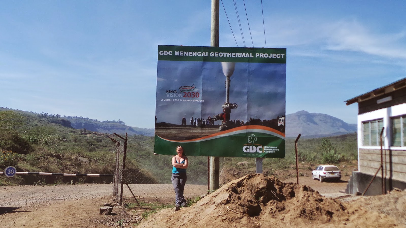
Menengai Geothermal Project
I feel very fortunate to be working on such an important project. I love being in the field and geology has and always will fascinate me. This project allows me to indulge in volcanology and structural geology as well as geochemistry. It has also given me the opportunity to learn the engineering side of the work being done here. But in addition, I am contributing to a project that will very soon be changing the lives of so many people. I have met some amazing and friendly people. Everyone in the caldera who sees us working, stops to say hello, they are curious as to what we are doing, they want to shake hands and wish us luck. The children always wave to us and we have even had a big cheer at the end of a school day. So many people here have very little, but they are all so happy.
Lala Salama from Kenya!
Day 17 - The Tuff vs The Bomb Puzzle
We are getting close to the end of our time here with only 3
more days in the field left. I at least will be very sad to go.
I have found with fieldwork in the past that as you draw to
the end of a trip, regardless of how long that trip might be, the fieldwork
tiredness starts to kick in. This trip I have been up early most days (around
6am) checking base maps, site maps, Google Earth (when the internet works!) and
LandSat images in order to plan the day. This might sound somewhat last minute,
but we have found on many occasions during this trip that the day’s plans can
often change last minute. So I go to bed with an idea of the next day’s plan,
but organise in the morning.
Our days in the field have varied from around 6 hours to
close to 10 hours, with the shorter days usually being the hottest. It’s easy
to forget how much the heat can take it out of you. It’s not like sunning
yourself on a great beach. It’s hot and very dusty, with a heavy field bag on
occasion and walking several kilometres most days, often up steep hills. Don’t
get me wrong, I’m not complaining, I genuinely love what I do and hope others
may be inspired too.
After each day in the field, we get back, get our things
ready for the next day, shower (though our nails get cleaned in the caldera
using the high pressure water from the pipes!), work more (blog writing,
emails, in my case go over what has been covered on that day), dinner and work
a bit more. The day usually ends around 11pm. So as you can imagine, doing that
for (currently) 17 days straight and by the time we finish here 20 days, plus 2
days travel, it catches up with you.

Cleaning the fingernails!
So on to today. The plan was to try and locate evidence that
indicates that the Solai TVA cuts in to the caldera along the eastern edge.
Satellite images show there to be something. But after yesterday, we know this
may be inaccurate or a trick of the sunlight. We found a round that would take
us between the plantations of maize, corn and bananas. After driving as far as
we could we walked a little further until we could see the caldera security
gate. Immediately south we could see two outcrops in the cliff face. We could
have used an old farmers path to walk across, however, the advise from our
driver was that we shouldn’t, because we hadn’t asked for permission. In the UK
we have ‘right to roam’ or you would simply ask the land owner. Here you have
to ask community elders and often you would be accompanied by one. But it’s not
the end of the world. It was still possible to record some approximate data.
And should I feel this area needs looking at in more detail on my trip next
year, I can make use of the many contacts and friends I have made on this
visit, to arrange access next time.
We decided to go back in to the caldera, heading to an area
already visited, the south. As we observed on Day 5, there are at least two
faults that run north-south from Nakuru to the edge of the caldera. There are
many articles available with schematic style maps of Menengai caldera showing
these faults, then inferring their continuation in to the caldera.
Referring
once again to satellite imagery, it is possible to see where one of the fault
traces might be observable. In the same locality there are two very large
mounds that we wanted to check out. They sit on a north-south trend and there
have been reports of young cinder cones on this trend also. These mounds
however, looked to be the northern extent of one of the hummocky terrains. We
also went back and observed the glassy scoria type bombs buried in tuff that we
observed on Day 9.
For the fault we parked up and walked across about 100m of
gently sloping compact tuff covered land to a steep sided gulley, the
opposite side there was a dark blocky lava flow. This gulley was on the right
trend and in line with what looks to be a fault trace in the distant caldera
wall. As this gulley cuts through tuff, there were no slickenlines or other
structures that we could measure and record. I know see why the faults with in
this part of the caldera have remained inferred. I too would go as far as to
infer myself.

The immediate fore-front of the image is the drop off in to the gulley that is a likely location for one of the faults inferred to run from Nakuru to the caldera and in to the caldera.
Our last task of the day was to look at the bombs buried in
tuff.
There are several models for caldera collapse: Plate/Piston
Collapse – involves the collapse of a whole block in to a chamber along a ring
fault; Piecemeal – the collapse of numerous floor blocks due to multiple magma
chambers, tectonically controlled faults in the caldera floor or if the entire
caldera is a mega breccia; Trapdoor – formed when subsidence occurs in an
incomplete ring fault or where subsidence occurs assymetrically in a complete
ring structure; Downsag – occurs where ring faults are absent and the rocks
overlying the magma chamber deform without fracture; and, Funnel – formed as a
result of piecemeal collapse or non-chaotic collapse with a deeper single
collapse at the centre and a distinct v or funnel shape.
The general consensus is that Menengai is of the piecemeal
style of collapse. The reason we wanted to return to the location where the
tuff has buried glassy scoria type bombs is due to the development stages of
Menengai caldera highlighted by Lipman (1984, 2000).
The author states the development of Menengai caldera
occurred in four stages as follows:
Stage 1: Pre-collapse volcanism; this stage involves
frequent surface volcanism that is sometimes explosive, magma accumulation and
migration.
Stage 2: Caldera subsidence; collapse associated with large
scale magmatic eruptions beginning with a central vent phase, proceeding to a
ring vent phase coincident with caldera collapse.
Stage 3: Post-collapse magmatism and resurgence; volcanism
is randomly scattered with in the caldera or localise along regional structural
trends. A renewed rise of magma results in the uplift or doming of the central
part of the caldera.
Stage 4: Hydrothermal activity and mineralisation; often
occurring throughout the life of the caldera, dominating late in the cycle
developing geothermal systems.
The ash flow tuffs are associated with syn-caldera collapse
and the glassy lava flows are post-caldera collapse. Yet here we have evidence
of apparently syn-collapse tuffs burying post-collapse glassy lava bombs. The
wrong way round when compared to the collapse stages.

The pale rubble immediately above my notebook is a bomb. It's crust has been altered to a clay, but the inside remains a glassy bomb with very large vesicles


Large vesicles at the core of the bomb segments
Our thoughts behind this evidence are: (1) The tuffs within
the caldera are not Menengai tuffs, but tuffs from other volcanic activity
burying some of the post-collapse bombs of Menengai; or (2) Tuffs have been
deposited after a section of the caldera has collapsed. That syn-collapse phase
has subsided in to the post-collapse glassy explosive phase producing bombs.
While elsewhere another collapse has generated the syn-collapse tuff deposits
that are falling at the same time as the post-collapse glassy bombs from an
earlier collapse location within the caldera.
Glassy 'scoria like' bombs in tuff
I have previously mentioned that the tuff deposits with in
the caldera seem to be quite fine grained for the source to be the location of
deposition, even more so as tuff deposits from the collapse have been
identified 45km away. But saying that, based on the piecemeal model of
collapse, (2) seems more likely.
Tomorrow we plan to visit a steep gulley observed from a
distance a few days ago. Keep following to find out what it might be.
Lala Salama from Kenya!
Saturday 20 September 2014
Day 16 - A Wild Volcano Chase
Well the morning started by a wakeup call from a very noisy
bird right outside our tent, followed by fighting (very loudly) between two of
the big male baboons. One of the males has been outcast from the troop as he
challenged the head honcho and lost. So now he is trying to fight his way back
in, and apparently failing!

Head honcho is at the back.
Observations I made of the region prior to coming using
Google Satellite, revealed two volcanic craters that have been quite
impressively affected by EAR faulting. Sleeping Warrior (aka Split Crater) and
another that by all accounts has no name. We visited Split Crater back on Day
3, a volcanic cone that has been cut through the middle by a fault resulting in
vertical displacement.
As with Sleeping Warrior, the reason to observe the second
crater is because the effect of faulting on Menengai caldera cannot be observed
as new lavas bury any evidence of fault traces at the surface. Additionally, as
previously mentioned, access to the caldera walls to observe any structures, is
impossible.
The second crater is about 2km south of Sleeping Warrior. Using the
satellite imagery, this crater appeared to have around 100m of horizontal
displacement. I wanted to have a look at this because although faults are very
rarely clean cut; and by this I mean a fault that is dominated by vertical
displacement will have a horizontal element and a fault dominated by horizontal
displacement will have a vertical element, I felt it unusual for the fault to
be dominated by horizontal displacement in a region that is rifting. All the
faults for miles around display vertical displacement as the dominant faulting
mechanism, as would be expected.
So, we drove south along the main Nakuru-Nairobi Road to
Gilgil, where we needed to turn off. This is where the fun began. We stopped to
ask the locals for directions. As on our visit to Sleeping Warrior, many
thought we were talking about Olkaria or Longonot to the south, both of which
are being/have been developed for geothermal energy. With the assistance of our
amazing driver, we managed to get directions, albeit vague ones. Altogether we
stopped for directions four times, with two people joining us for the
adventure. We still ended up at the wrong crater! This crater was certainly elusive.

The grey linear structure in this image is the location of the fumaroles as seen from the top of the volcano.
Using the satellite images and a good old trusty compass, we
managed to approximately locate ourselves as being one crater west of our
intended target. A trek among the zebras and a short climb was now required. Finally
reaching the top of the crater shoulder and walking around the crater rim, we
were satisfied this was our final destination. Over 2 hours drive and 2 hours
walking around, we had found it.
As is the case rarely in geology, it was actually a little
disappointing. It is a shield volcano, surrounded by predominantly
strato-volcanoes, the crater was very shallow, but the reason for the visit,
the horizontal displacement was almost negligible! We did however notice fumarole activity close to the base of the volcano along a large fracture that ran almost north-south, again an expected structural trend.
From the bottom of the volcano, it was possible to get an idea of how flat the rift floor is in places, with the multiple, individual volcanic cones spread across the area.

This image shows just some of the many small cones that scatter th rift floor in this region
However, this does highlight an important point that I have mentioned a few times now. The importance of fieldwork. As geologists we have access to all sorts of imagery and data sets, and most of the time this is very advantageous. But on occasion, they can have the opposite effect. I could have quite easily made an assumption on the basis of the images, that there was more strike slip faulting in the region than maybe first thought. Of course assumptions are not ideal, but sometimes cannot be avoided. But should I have done that and not made the time to visit the location, subsequent reports could have contained information that is actually irrelevant.
Tomorrows work will either be a return to a location we want to observe more within the caldera, or work along the top of the north east caldera wall.
Lala Salama from Kenya!
Friday 19 September 2014
Day 15 - Chilly Lavas
Geology days are always very varied. Many days you may find the weird and wonderful or unexpected. Other days, like today, they are much easier. We are very close to the end of our time here, so identifying individual lava flows has become a little easier. Today there were no real surprises, the only characteristics observed that were new, were gulleys that look like lava gulleys. This is where lava would have once flowed through already cooled lava, carving a path through and smoothing the gulley edges. There were small hints of flow bands on the gulley sides.


A gulley, likely to have been carved and smoothed by a lava flow.
So today was the final big mapping day, covering the eastern area of the caldera. We had several ropey lava flows to distinguish one form the other, the scoria type lava overlying the ropeys and a very impressive chilled margin.
Checking out a great example of a chilled margin
Now, using colour as a way of identifying something in geology is always advised against. But occasionally it does help. From a distance the base of this lava flow appears to grade from dark to light. Knowing I was looking at multiple lava flows, one over the other, and recalling what I have seen on fieldwork in places such as Cyprus and Cornwall, the graded colouration got me wondering, Is it a chilled margin?
The left of the image shows a dark grey, almost black at the base of a flow, getting paler upwards.
The base of the chilled margin is almost glassy, grading to fine grained (can just see with a hand lens) to the smaller end of medium grained. This image does not do it justice.
How can this 'on the ground' work be used? Well seeing it allows a geologist to get a much more accurate impression of the area. Images and data are great, but I've said it before and I'll say it again, there is nothing like being in the field.
What we have been able to establish is that the lower down the stratigraphy the narrower the ropes are. Something you wouldn't get from data or satellite images. The scoria type lavas that overlie the ropeys in all examples. are likely to have been a high viscosity flow and the blocky appearance is due to the cooled flow being brecciated by the energy of the flow behind it.
We can establish the sequence of flows and chemical analysis of samples from different flows will allow geochemists to at least being to unravel what is going on in the subsurface based on the composition of the different flows. And where there is enough feldspar, dating the flows can also be accomplished.
Tomorrow we are off to look at the affects of horizontal displacement on a volcano.
Lala Salama from Kenya!
Day 14 - Rocks, snakes and leopards
Today we had arranged to walk down in to the caldera with Lucy the guide from our accommodation. We were heading towards the south eats corner. To be honest, the south east corner of the caldera is the only area that I hadn't planned on observing the caldera walls. The literature and observations of Google Earth images gave me reason to believe structures would be limited in comparison to the other areas. The caldera walls in the areas I had planned on visiting are inaccessible, so again, plans changed.

From our accommodation we had noticed a very straight structure we wanted to check out. We also wanted to try and establish how many flows there are in this locality.
So a later start to the day, leaving at 1030am, it took close to 3 hours just to get to the base of the lava target lava flows. This was after walking through the south east baboon troop, who were too busy playing and squabbling to notice us; watching the not so shy rock hyrax chilling in the shade; dodging a 100 strong heard of cows using the same narrow path as us, scrambling up and down steep sided flows and topography through snake and hyena country.


Once satisfied that we had all the information we wanted, we headed back. The paths were even harder to spot this way. That's if you can call them paths at all. More like occasionally trodden routes by the herds.

Climbing back up to the shoulder of the caldera shoulder, we were able to record some data relating to fracturing, some areas locally had columnar characteristics, but not consistent enough for columnar joints. The walk again involved dodging the cows! While working, our guide had a good old chit chat with one of the herders.

When we arrived here two weeks ago, we made some enquiries with the staff at our accommodation regarding wildlife we mat need to be wary or aware of. I had read in a planning report that evidence of leopards had been found in the caldera. So I asked. The reply was a resounding no. How wrong could they be.
Apparently the herders had been watching us from afar, thinking we were a bit crazy. Lucy's conversation revealed that not only were there leopards in the caldera, but they had seen one just this morning in the exact spot we had been sampling from! No leopards in the caldera indeed! I don't think we would have ventured so far away from the path if we had known. And the rock pythons are big enough to eat a calf!
The day was a shorter than normal a day at almost seven hours, most of which was spent clambering, topped off with a dip in the pool. Well Jenny did, dipped toes was enough for me.
Tomorrow is another mapping day, concentrating on the western area of the caldera.
Lala Salama from Kenya
Jenny, Lucy our guide and me
From our accommodation we had noticed a very straight structure we wanted to check out. We also wanted to try and establish how many flows there are in this locality.
So a later start to the day, leaving at 1030am, it took close to 3 hours just to get to the base of the lava target lava flows. This was after walking through the south east baboon troop, who were too busy playing and squabbling to notice us; watching the not so shy rock hyrax chilling in the shade; dodging a 100 strong heard of cows using the same narrow path as us, scrambling up and down steep sided flows and topography through snake and hyena country.
A rare occasion of catching a rock hyrax prepared to sit still long enough for a picture
No snakes today, just the skin of a spitting cobra. The heat in the caldera today was the highest yet, with no breeze. We decided to work fast as thunderstorms were also forecast. We collected samples and spent quite sometime discussing the different flows, where they started, where they ended and how many there are in this part of the caldera. The region is dominated by the young lavas that I have been referring too as 'scoria like', underlain by flows that seem quite broken up. From above the flows it appears that the youngest flow has bulldozed in to the flow immediately below, forming huge 'ripples'. This suggests that the lower of the two flows was not yet likely to have completely cooled.
There are three flows in this picture. Can you spot them? The furthest flow is where the we got too. It is much further than it looks, as there is no 'as the crow flies' distance in geology mapping. There is always a steep drop off, river, animal home, to try and avoid.
Avoiding the 100 strong herd. This path looks pretty narrow. And it was. But it was the widest.
Climbing back up to the shoulder of the caldera shoulder, we were able to record some data relating to fracturing, some areas locally had columnar characteristics, but not consistent enough for columnar joints. The walk again involved dodging the cows! While working, our guide had a good old chit chat with one of the herders.
Collecting data.
When we arrived here two weeks ago, we made some enquiries with the staff at our accommodation regarding wildlife we mat need to be wary or aware of. I had read in a planning report that evidence of leopards had been found in the caldera. So I asked. The reply was a resounding no. How wrong could they be.
Apparently the herders had been watching us from afar, thinking we were a bit crazy. Lucy's conversation revealed that not only were there leopards in the caldera, but they had seen one just this morning in the exact spot we had been sampling from! No leopards in the caldera indeed! I don't think we would have ventured so far away from the path if we had known. And the rock pythons are big enough to eat a calf!
The day was a shorter than normal a day at almost seven hours, most of which was spent clambering, topped off with a dip in the pool. Well Jenny did, dipped toes was enough for me.
Tomorrow is another mapping day, concentrating on the western area of the caldera.
Lala Salama from Kenya
Wednesday 17 September 2014
Day 13 - The Mapping Continues! With a yellow alien growth....
Most days are usually eventful in the field. You get to meet great people, most are very helpful and curious too. But every so often, you get a day that is simple, clear cut and to the point.
So today was a continuation of mapping, using the roads as a guide. The technique often used when mapping boundaries involves finding the point of contact between one unit and the next. Once that point has been located, you follow the boundary along the ground. At a chosen distance, which depends on the size of the area being mapped and the scale of the base map being used, a geologist would then locate themselves using a compass or GPS, collect any relevant data and mark it on the base map. Yes, there is a vast array of technology available to assist with this, along with various agencies with satellite imagery that can be used. But there is nothing like being out in the field and seeing it for real. Doing so usually aids the understanding of complex areas also.
En route to our starting point we found a second fumarole site. This like the last, can be a site used for surface emanation gas sampling during my next visit. Although the surface emanations were individual, there was a row of them covering about 30 meters. Like the previous area, the origin of the emanations were ropey lava flows. However, the small emanations from Day 7 and Day 12 were from a ropey flow low in the stratigraphy. Theses emanations were also concentrated so they were coming through the spatter and volcanic bomb deposits on top of the flow. Today's emanations were coming from a ropey flow higher in the stratigraphy and emanating from fractures and miniature fissures within the flow wall. It was possible to climb up above the emanations, where no obvious emanations on top of the flow were observed.


We concentrated on the northern part of the caldera, observing the opposite side of some lava flows recorded on Day 10. In this area, some of the ropey lavas are much thicker. I am still trying to establish if they are the same flows previously observed, that have spread across the caldera, or altogether separate. In this region, there appears to be four individual ropey flows, plus another flow lower again in the stratigraphy that cannot be identified at the moment.

So today was a continuation of mapping, using the roads as a guide. The technique often used when mapping boundaries involves finding the point of contact between one unit and the next. Once that point has been located, you follow the boundary along the ground. At a chosen distance, which depends on the size of the area being mapped and the scale of the base map being used, a geologist would then locate themselves using a compass or GPS, collect any relevant data and mark it on the base map. Yes, there is a vast array of technology available to assist with this, along with various agencies with satellite imagery that can be used. But there is nothing like being out in the field and seeing it for real. Doing so usually aids the understanding of complex areas also.
En route to our starting point we found a second fumarole site. This like the last, can be a site used for surface emanation gas sampling during my next visit. Although the surface emanations were individual, there was a row of them covering about 30 meters. Like the previous area, the origin of the emanations were ropey lava flows. However, the small emanations from Day 7 and Day 12 were from a ropey flow low in the stratigraphy. Theses emanations were also concentrated so they were coming through the spatter and volcanic bomb deposits on top of the flow. Today's emanations were coming from a ropey flow higher in the stratigraphy and emanating from fractures and miniature fissures within the flow wall. It was possible to climb up above the emanations, where no obvious emanations on top of the flow were observed.
Surface emanations in the wall of a lava flow
GPS for scale. One of the emanation origins. Not sure what the yellow is. I had thought it would be sulphur, as there is sulphur near by. But there is no smell and it moves in the breeze. It also looks slimy, but isn't. A bacteria of some sort? Answers on a post card please.
We concentrated on the northern part of the caldera, observing the opposite side of some lava flows recorded on Day 10. In this area, some of the ropey lavas are much thicker. I am still trying to establish if they are the same flows previously observed, that have spread across the caldera, or altogether separate. In this region, there appears to be four individual ropey flows, plus another flow lower again in the stratigraphy that cannot be identified at the moment.
This picture was taken standing on a ropey lava flow, looking up to a second overlying flow, topped with a scoria type flow.
As lava doesn't flow in a straight line and quite often forms multiple fingers at the same time it is often a challenge to establish which flow goes with which. This challenge is also added to when the heights and/or thicknesses of flows are also controlled by the underlying topography.
Tomorrow we are off out with Lucy from our accommodation, who is taking us down to the south east corner of the crater where we are hoping there might be evidence of faulting associated with the Solai TVA.
Lala Salama from Kenya!
Day 12 - Eggs. Volcano Style!
Firstly, I apologise for the slight delay on this post. Several afternoon thunderstorms and torrential downpours over the caldera resulted in a ten hour power cut.


So what were we up to? The day actually began the day before, organising to borrow a few bits from the kitchen and arranging a packed breakfast instead of lunch.
I thought a little experiment could be fun and interesting. It involved 4 raw eggs and the fumaroles from Day 7.
We left the accommodation at 5.30am, thankfully our driver is a morning person. We arrived at the security gate with sunrise about 30 minutes later and drove to the fumaroles. The contrast between the early morning air temperatures and the fumaroles meant the looked very impressive.

Sunrise over the caldera
Steamy morning. Jenny and myself are in there somewhere.
My field assists carried the basket of supplies and equipment to the fumaroles. Then we spent a little time walking to the sites that were producing more steam to test the heat escaping, selecting two.
My wonderful assists
We put two eggs in to a pan of water that was sat over a fumarole, packing the gaps with bits of lava and grass to reduce how much heat escaped. One egg went in a ceramic bowl with a plate over the top and one egg was simple put in the fumarole just as it is.
Insulating the pan
Another egg all snug in a bowl.
After 25 minutes we took the eggs from the bowl and the fumarole. The one in the bowl didn't quite work. It had began to cook on the outside, but the white and the yolk on the inside were still too runny too eat. The egg that we had just left as it was cooked well, with a slightly runny yolk. The one that didn't work we put on a plate and put it back in to a fumarole. After about 45 minutes we took it out again to find it was almost poached.
Almost poached!
When putting the eggs in to the pan, the shells cracked just a little. After 40 minutes, we took the eggs out, they were certainly hot. But we could tell by gently pushing on the shells where they had cracked that they needed a little longer. So back in to water for about 15 minutes. The water never reached boiling point, but simmered well, so a 5 minute boiled egg was out of the question!
While waiting for the eggs we spent a little more time at the largest fumarole, the steam sometimes making it quite difficult to see and drinking coffee!
It is me, honest! This was the better picture taken. Some, you wouldn't have known it was me.
Wakey wakey!
Back to the eggs! After the extended time in the water, removing the eggs and peeling them, the waiting game was over. Did we have hard boiled eggs???
Hard boiled eggs. Volcano style! And it didn't taste to bad either.
It worked, though it was a long time coming. The success shows that the temperatures of the fumaroles are very high in places. We found that fumaroles that were too hot to leave our hands in on Day 7 were not the hottest today. Shame the temperatures were not high enough today to boil water.
Experiment over. Time to map the fissures.
Mariita (2013), has a very simplistic straight line representing the position responsible for young fissure eruptions. It is rare for a structure of some size to have perfectly straight edges or orientations. I have seen inactive fissures during fieldwork to Mount Etna. They were 'wavy' in plan view but relatively simple, they also increased in depth with elevation. The fissures of Menengai are very complex, very deep and often very difficult to access. The longest fissure we found, we were able to follow for 500 meters before the vegetation and terrain became impossible to tackle.
One of the many fissures
Calculating fissure trends
The lavas that the fissure cuts through could however be traced over a greater distance and the opposite end located. Making this fissure close to kilometre long. It began in the north with a NW-SE trend and curved to have an almost N-S trend. Based on our observations, this is the dominant fissure that is likely to feed the other fissures we found. Other fissures also had trends of NW-SE and N-S, but also NE-SW and WNW-ESE. We have found ten fissures that almost certainly form a network. We are also sure there are many more. But during road construction some have been filled with debris. It was also possible to infer the location of some just by simply observing sections of the road that had begun to collapse in line with or along the same trend as though we were able to clearly observe.
Tomorrow, it is back to road mapping!
Monday 15 September 2014
Day 11 - Tuff Day
Today was another day mapping, we needed to finish off
mapping the western side of the caldera. After security let us out of the
caldera and we were happy they would let us back in (this security check is
different to our normal one, where everyone knows us now), we drove to the western
edge of the caldera.
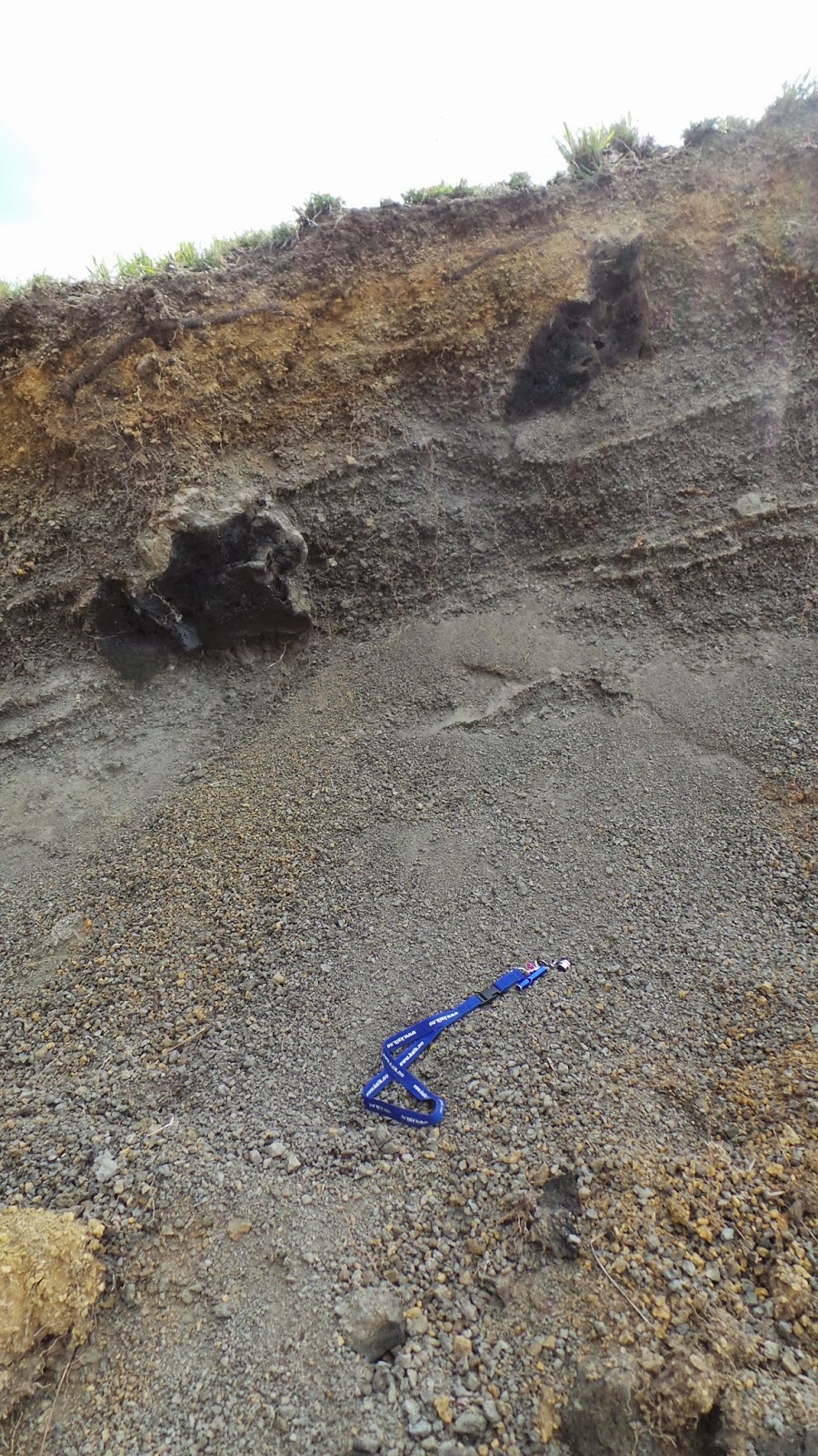
Starting on the caldera shoulder, we found a unit about 30cm
thick that was full of angular clasts of volcanic debris. Above this there was
a unit that looked very much like a lahar. It contained small clasts from 3mm
to 2cm in size in a muddy matrix.
The lahar had a sharp contact with lava that in cross
section had an undulating outline. Above this, there were many layers of tuff
ranging in thickness from 4cm to around 30cm, alternating with layers of palaeosols. Each layer fines up with grains
from approximately 500µm to 5mm. The grains are still smaller than I would
expect to see if the tuff was associated with the Menengai eruptions. Fines from
a pyroclastic eruption are so small and so light they are ejected sometimes 10’s
of kilometres in to the atmosphere. Once at such altitudes, the winds carry the
fine particles many miles, sometimes around the world. Even particles of the
sizes seen at Menengai would be carried great distances as a lot of the
particles are very pumaceous making them very light weight. Overlying these tuff deposits are further tuff deposits. Each individual layer measures between 50cm and 1m. however, the thickness of the individual layers varies horizontally.

A handful of tuff!
In this area of the caldera, the walls are much
lower than the south east area for example. Here they are about 100m high, with
tuff deposits making up the last 15-20m. About 8-10m up in caldera wall, in stark contrast to the surrounding deposits, there is a white layer that does not appear to contain much in the way of debris. As the height means close observations of this deposit can not be made. The inference made about this unit is that it is a crystal tuff. This is based on the clay observed on a previous day that we believe to be a hydrothermally altered crystal tuff.
Some of the tuff deposits observed in the caldera wall.
Today was a rare occasion where we managed to sit and enjoy lunch instead of eating on the go. We found a flat topped Acacia tree to shelter from the midday heat and enjoy. While eating we were lucky to see the golden breasted starlings flying near by. A very pretty bird with an orange underbelly and iridescent blue/purple wings.
Lunch time.
Unlike other areas of the caldera, in this region there are
large areas covered by tuff. If like other areas there is ropey lava buried beneath,
it is not seen here. I estimate that we walked 2kn through tuff before finding evidence
of ropey lava.
Characteristics not seen anywhere else so far, are many small
mounds. These mounds are overlain by tuff that follow the topography. These
mounds are often 20-30m high and sometimes elongate. These mounds remind me of
the hummocks observed when on fieldwork in Sicily. These hummocks were associated with
the 6000 year old collapse of the east flank of Mount Etna. Although here, the
collapse mechanisms are not quite the same, there are similarities. I believe that these structures observed today are hummocks.

A hummock cut by the road. Volcanic debris in the middle of the image, covered by tuff. Me for scale
Heading along the road towards the west, although lava flows
were yet to be seen, we started to observe volcanic bombs on top of the
hummocks, the sizes of which decreased the further west we walked. Finally we found evidence of ropey lava with
flows towards the north-west. Unlike previous observations, here the ropey lava
does not appear to be buried under tuff, then exposed due to erosional
processes. The only way this might have been the case, is if the areas of
tuff we observed, buried lava and we just didn’t see evidence for this.
The ropey lavas were once again very pumaceous in appearance
and appeared to be of one flow exposed along about 500m of road length. The final
500m the lava flow was much more blocky and darker, but not as dark and scoria type, as seen in the youngest flows. It was easy to observe shallow fissures that became
much deeper over the last 500m with the increase in elevation. The trend
direction of these is similar to those observed on 2 previous days and are
likely to be part of the same network of fissures.
While I was having a much deserved shower, Jenny had a surprise when she looked out of the door to our bandanas to find a baboon sat on the fence post less than 5 meters away. Cheeky monkey ran away! We watched for a while as there were four big males, partly watching us, partly watching something else. We soon worked out they were standing guard, watching for the southern troop that were close to theirs, the northern troop's, territory.
While I was having a much deserved shower, Jenny had a surprise when she looked out of the door to our bandanas to find a baboon sat on the fence post less than 5 meters away. Cheeky monkey ran away! We watched for a while as there were four big males, partly watching us, partly watching something else. We soon worked out they were standing guard, watching for the southern troop that were close to theirs, the northern troop's, territory.
Tomorrow has the potential to be a bit different, I'm keeping my fingers crossed, it goes to plan. That is all I will say for now, 5.30am start.
Lala Salama from Kenya!
Sunday 14 September 2014
Day 10 - Today Cannot be Faulted, We Found a Fault!
Last night I heard the hyenas and the monkeys and I am
currently sitting writing this listening to natures chorus of crickets, bats
and some night birds.
Another gloriously sunny day and the temperature is rising
daily.
Today we are continuing with mapping by following the roads,
but heading towards the west side of the caldera. An unintentional stumble upon
workers starting to install electrical cables close to MW-19, prompted a query,
Is a rig on the move to well MW-19? Yes it is!
On our visit to MW-09 on day 2, we were told that a rig and
everything that comes with it, can be dismantled, moved and rebuilt at a new
well location in 21 days. Which when you see exactly what that entails, is very
impressive. The rig that is on the move is Great Rift Drilling Rig 1. I hoped
to catch a daily record of the rig being dismantled and at least some of the
reconstruction at its’ new location. However, it looks like the rig has already
come down. So I hope to record it going up over the remaining 10 days or so. I will keep you posted.
Boundary mapping of lava flows can get quite complicated
when you have multiple flows, in different directions, often obscured by dense
vegetation and can’t be climbed on for reasons of safety. So a large amount of
today was spent walking along roads, at every 100m, stopping, locating our
position, taking a baring towards the flow being mapped, estimating how far it
is away from said location and noting its trend and where possible, flow
direction (and dodging the cows!). But in many cases it also involved trying to establish whether flows
were the same but having changed direction. Or alternatively, do they appear
higher/lower because they are different flows or because they have followed
topography.

One of many herds of cows
Ropey lava of two flows were identified along with a much
younger but darker flow that is very blocky and broken up. The ropey flows are
usually fairly easy to climb over and investigate in some detail. It is these
younger darker flows that are dangerous. They are very high, steep sided, sometimes
almost vertical. It’s estimated that the young flow observed in the north west
of the caldera ranges in height from 30m to 50m and if like others we have attempted
to climb, it is likely to be very unstable and home to venomous snakes.

Ropey Lava. The flow covered a large area and split in to three different flows.
The source of this flow is the NW corner where there is a
small crater. This began life as a flank crater to the 200,000 year old shield
volcano that is now Menengai caldera.

Entering the lava field at the NW corner of the caldera
The collapse of the volcano also caused
the collapse of a section of the craters rim, allowing for lava from this
eruption centre to flow in to the caldera. This part of the caldera is very
quiet. A road has been constructed but no drilling related work has yet started
and as we walked further west along the road, found that there had been a few small
rock falls, one of which seemed to still be moving a little. The only living
things using the area are the lizards and the monkeys.

A red blue lizard that turned his back just as I snapped
Walking along the road immediately to the south, just a few
meters away from the road, 1m up and accessible, we found a pale coloured
surface. It stood out because we were among such dark lavas. Closer inspection
revealed slicken fibres and slicken lines. Brilliant! We have finally found a
fault that we can gain access to and record some data. Yes, we are in a very
tectonically active region. But here everything has been buried by young lavas
and the faults haven’t moved much (if at all) since. Walking further, we found
that a large section of the lava flow normally very blocky and full of gaps,
became a smooth surface. More slicken fibres and slicken lines confirmed that
this was a continuation of the fault. The data supports this as a normal fault
with an E-W trend. It is difficult to estimate the offset from essentially with
in the fault. The fault could be seen in the distance cutting through the wall
of the flank crater. It is likely the pale surface where the fault plane was
first observed is clay that has hardened over time. The source of this is
likely to be feldspars with in the lavas. The heat generated due to friction
along the fault plane when a fault moves, will cause alteration and water that
would have flowed along the fault at a time in the past would have collected
and deposited the clay on the plane. It may have formed a clay gouge that no
longer exists as the road has been constructed along the fault.
Jenny has spent the day whistling the whistle call from The Hunger Games. We hear the Mocking Jays, she is determined to teach them the call from the film before we leave. One smart bird managed three notes. We finished they day munching on street corn. A giant corn on the cob, harvested from the crops near by. It is cooked dry in a fire and tastes like popcorn, but with out the calories!

Lala Salama from Kenya.
Subscribe to:
Posts (Atom)